


Spatial Intelligence Platform
Transforming Data into
Spatial Intelligence
Smarter cities, sustainable resources, and efficient delivery management
6Simplex transforms urban planning, natural resource management, and delivery management with cutting-edge solutions. Our innovative products, Revelo — a Spatial Decision Support System, and Phantom — a Smart Delivery & Field Operations Platform, empower businesses and governments to make data-driven decisions for a smarter, more sustainable world.
Powering Complex Operations
6Simplex platforms support organizations working in complex operational environments across multiple sectors.
Delivery Management
- Route Optimization
- Real-time Tracking
- Delivery Efficiency
Natural Resources
- Forest Assets Management
- Plantation Monitoring
- Tree Census
Urban Solutions
- Water Utilities Management
- Smart City Development
- Census & Rehabilitation
Turning Location-Based Data into Intelligence
Our technology helps organizations turn location-based data into actionable intelligence.
Phantom
Delivery & Field Operations Management Platform. Plan routes, track deliveries, monitor teams, and analyze performance with real-time operational visibility.
Learn More →Revelo
Spatial Decision Support System. A powerful geospatial data platform that helps organizations manage, analyze, and visualize spatial information for smarter planning.
Learn More →Delivery Operations with Complete Visibility
Phantom is designed for businesses that run their own delivery fleets and field teams, offering unmatched control from warehouse to doorstep.
Define
Operational insights for better efficiency.
Monitor
Operational insights for better efficiency.
Analyze
Operational insights for better efficiency.
Improve
Operational insights for better efficiency.

Phantom Dashboard Preview
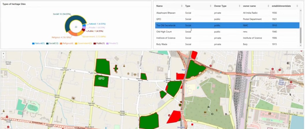
Revelo Spatial Dashboard
Spatial Intelligence for Real-World Operations
Revelo is designed for organizations that collect, manage, and analyze complex location-based data directly from the field.
Collect
Structured spatial data workflows for cross-functional teams.
Map
Structured spatial data workflows for cross-functional teams.
Manage
Structured spatial data workflows for cross-functional teams.
Analyze
Structured spatial data workflows for cross-functional teams.
Real Solutions for Real Problems
We focus on solving complex operational challenges, not just building software features.
Real-time Operational Visibility
See exactly what's happening on the ground, every moment.
Data-Driven Decision Support
Make smarter decisions backed by spatial intelligence and analytics.
Scalable GIS Technology
Grow your operations without limits. Our platform scales directly with your needs.
Custom Environments
Tailored solutions designed to fit your unique operational workflows.
We combine geospatial intelligence with practical operational tools to help organizations run smarter systems.
Ready to Transform Your
Spatial Data Management?
Join leading organizations that are leveraging geospatial intelligence to make smarter, faster, and more efficient decisions.